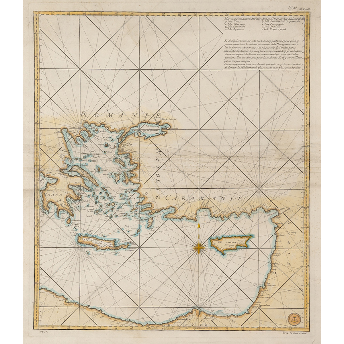
BELLIN JACQUES-NICOLAS
[Chart of the Mediterranean: Greece and the Eastern Mediterranean] III Feuille/ISLES COMPRISES ENTRE LE MERIDIEN DU CAP ST. ANGE ET CELUY D' ALEXANDRETTA. Επιχρωματισμένος χαλκόγραφος χάρτης του Αιγαίου και της Ανατ. Μεσογείου. Διαστάσεις 63 x 54 εκ. Επιδιορθωμένος. [Zacharakis 277/171]
200 - 250 €
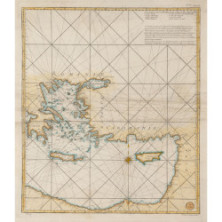
BELLIN JACQUES-NICOLAS
[Chart of the Mediterranean: Greece and the Eastern Mediterranean] III Feuille/ISLES COMPRISES ENTRE LE MERIDIEN DU CAP ST. ANGE ET CELUY D' ALEXANDRETTA. Επιχρωματισμένος χαλκόγραφος χάρτης του Αιγαίου και της Ανατ. Μεσογείου. Διαστάσεις 63 x 54 εκ. Επιδιορθωμένος. [Zacharakis 277/171]
200 - 250 €